


Voting District 0003, Zapata County, Texas
About
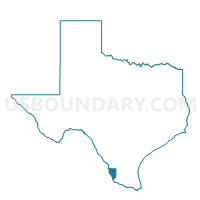
Outline

Summary
| Unique Area Identifier | 678375 |
| Name | Voting District 0003 |
| County | Zapata County |
| State | Texas |
| Area (square miles) | 55.23 |
| Land Area (square miles) | 38.63 |
| Water Area (square miles) | 16.60 |
| % of Land Area | 69.95 |
| % of Water Area | 30.05 |
| Latitude of the Internal Point | 26.82317170 |
| Longtitude of the Internal Point | -99.19779820 |
Maps


Graphs
Select a template below for downloading or customizing gragh for Voting District 0003, Zapata County, Texas


Neighbors
Neighoring Voting District (by Name) Neighboring Voting District on the Map
- Voting District 0001, Zapata County, TX
- Voting District 0002, Zapata County, TX
- Voting District 0004, Zapata County, TX
- Voting District 001B, Zapata County, TX
Top 10 Neighboring County Subdivision (by Population) Neighboring County Subdivision on the Map
Top 10 Neighboring Place (by Population) Neighboring Place on the Map
- Zapata CDP, TX (5,089)
- Siesta Shores CDP, TX (1,382)
- Falcon Lake Estates CDP, TX (1,036)
- Falcon Mesa CDP, TX (405)
- Morales-Sanchez CDP, TX (84)
Top 10 Neighboring Unified School District (by Population) Neighboring Unified School District on the Map
Top 10 Neighboring State Legislative District Lower Chamber (by Population) Neighboring State Legislative District Lower Chamber on the Map
Top 10 Neighboring State Legislative District Upper Chamber (by Population) Neighboring State Legislative District Upper Chamber on the Map
Top 10 Neighboring 111th Congressional District (by Population) Neighboring 111th Congressional District on the Map
Top 10 Neighboring Census Tract (by Population) Neighboring Census Tract on the Map
- Census Tract 9504, Zapata County, TX (5,610)
- Census Tract 9503.01, Zapata County, TX (4,384)
- Census Tract 9503.02, Zapata County, TX (4,024)